
Michael During the Covid lockdowns, we got into the habit of going for a walk every day, and at that time you either couldn't leave the city or had to quickly get a walk in before sunset, so I began to scope out intricate city hiking trails using websites like Google Maps and Komoot.com. San Francisco offers not only the well-known attractions for tourists, and even someone who has lived here for 20 years may not know every hidden staircase, urban hill, or mini-parks with breathtaking views, whether in rustic working-class neighborhoods or luxury districts built with old money.
And so, for a while, I put together new city hiking trails almost daily behind closed doors in stealth mode, which we then actually hiked, recorded, and reviewed. From the very best, which led through winding alleys, crossed the freeway on pedestrian bridges, or where you could admire beautiful old grand villas or simply enjoy an elevated panoramic view over the entire city, I created a coffee table book titled "San Francisco Urban Hikes", a heavy, splendid glossy photo volume with maps for the routes.
But as you know, my production mill never stops, so recently it occurred to me to throw the accumulated treasure all at once at the public’s feet by putting it out on the web at hikethiscity.com. And just like that, 57 of the best hiking trails in San Francisco are now online! So if you’re ever in the city, you can pick a few trails and navigate through them with the free Komoot app, which the detail pages on the website link to. You’ll be amazed!

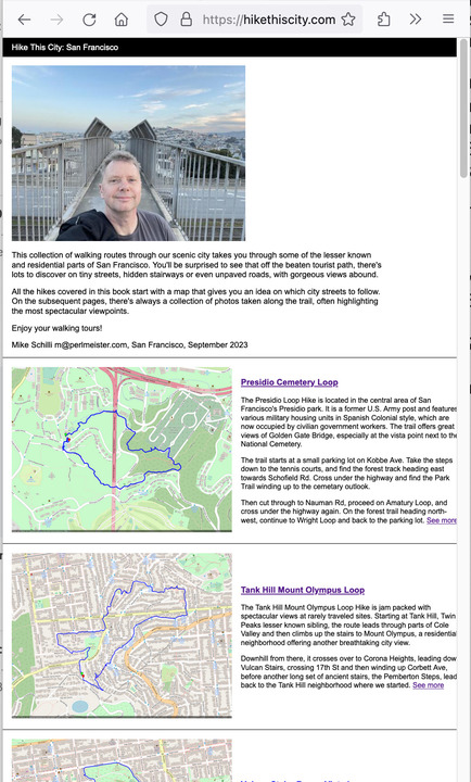
Now you can guess where the cover photo in Figure 4 was taken. Clearly in a more urban area of San Francisco, with a pedestrian bridge over a busy street, but with a wide view of the Bernal Heights and Potrero Hill neighborhoods. No tourist has wandered there yet!